| Introduction |
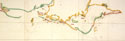
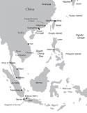 Important Trading Centers in East and Southeast Asia, 15th and 16th Centuries Important Trading Centers in East and Southeast Asia, 15th and 16th Centuries |
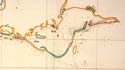
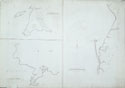
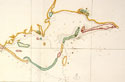
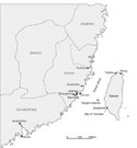 Taiwan Straits in the Seventeenth Century, Selected Sites Taiwan Straits in the Seventeenth Century, Selected Sites |
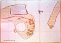
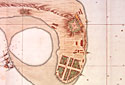
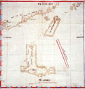
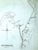
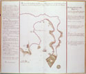 Map of Dutch Fortress on Penghu, c. 1623 Map of Dutch Fortress on Penghu, c. 1623 |
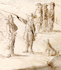
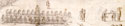
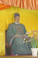
 A Chinese Merchant A Chinese Merchant |
|
| Chapter 1 |
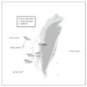
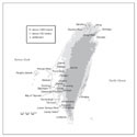
 Taiwan, Physical Map Taiwan, Physical Map |
 A Formosan, c. 1652 A Formosan, c. 1652 |
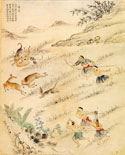 Hunting Deer (捕鹿), 1746 Hunting Deer (捕鹿), 1746 |
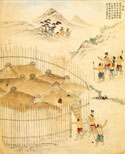 Defending the Pass (守隘), 1746 Defending the Pass (守隘), 1746 |
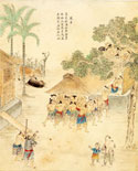 Raising the Roof (乘屋), 1746 Raising the Roof (乘屋), 1746 |
 Selected Siraya Villages, Taiwan, c. 1623 Selected Siraya Villages, Taiwan, c. 1623 |
 Husking Rice (舂米), 1746 Husking Rice (舂米), 1746 |
 Catching Fish (捕魚), 1746 Catching Fish (捕魚), 1746 |
|
| Chapter 2 |
 Bay of Tayouan, 1635 - General View Bay of Tayouan, 1635 - General View |
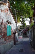 Old Anping Old Anping |
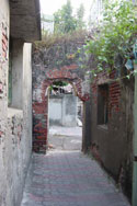 Old Archway in Anping Old Archway in Anping |
| Map of Dutch Fortress on Penghu, c. 1623 |
 Fort Zeelandia, 1635 - Detail 2 Fort Zeelandia, 1635 - Detail 2 |
|
| Chapter 3 |
| Selected Siraya Villages, Taiwan, c. 1623 |
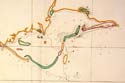
 Wankan and the Poncan River (Left is North) Wankan and the Poncan River (Left is North) |
 Murderers' River, c. 1636 (Left is North) Murderers' River, c. 1636 (Left is North) |
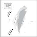
 Taiwan in the Mid-Seventeenth Century, Selected Sites Taiwan in the Mid-Seventeenth Century, Selected Sites |
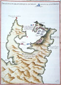
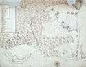
 Map of The Island of Formosa, 1636 Map of The Island of Formosa, 1636 |
|
| Chapter 4 |
| Taiwan in the Mid-Seventeenth Century, Selected Sites |
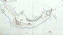
 Map of Luzon, Isla Hermosa (Taiwan), and a Part of the Coast of China, 1597 Map of Luzon, Isla Hermosa (Taiwan), and a Part of the Coast of China, 1597 |
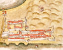
 Map of the Spanish Port in Jilong, Taiwan, 1626 Map of the Spanish Port in Jilong, Taiwan, 1626 |
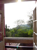 View from the Fortress at Danshui View from the Fortress at Danshui |
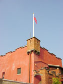 Fortress at Danshui Fortress at Danshui |
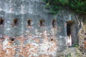
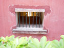 Cell at the Fortress at Danshui Cell at the Fortress at Danshui |
 Map of Danshui and Surrounding Areas, Including the Island of Jilong, 1654 Map of Danshui and Surrounding Areas, Including the Island of Jilong, 1654 |
|
| Chapter 5 |
 Jilong Island, 1654 - Detail 1 Jilong Island, 1654 - Detail 1 |
 Jilong Island - Detail Jilong Island - Detail |
Map of Danshui and Surrounding Areas, Including the Island of Jilong, 1654 |
| Chapter 6 |
| A Chinese Merchant |
 The Bay of Tayouan and Environs - Detail The Bay of Tayouan and Environs - Detail |
 Navigation Charts of Jilong and the Bay of Tayouan Navigation Charts of Jilong and the Bay of Tayouan |
 The Bay of Tayouan, Detail from Nautical Chart, 1636 The Bay of Tayouan, Detail from Nautical Chart, 1636 |
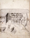
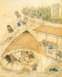 Sugar Mill (糖), 1746 Sugar Mill (糖), 1746 |
 Gotha, Forschungs- bibliothek, Chart. B 533 Gotha, Forschungs- bibliothek, Chart. B 533 |
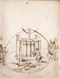
 Sugar Press, Brasil - 2, Mid-1600s Sugar Press, Brasil - 2, Mid-1600s |
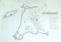
 Map of Roads and Cultivated Fields in the Saccam Area, 1644 Map of Roads and Cultivated Fields in the Saccam Area, 1644 |
|
| Chapter 7 |
| Taiwan in the Mid-Seventeenth Century, Selected Sites |
Hunting Deer (捕鹿), 1746 |
 Southwestern Coast of Taiwan, Showing the Wankan Area (Left is North) - Detail Southwestern Coast of Taiwan, Showing the Wankan Area (Left is North) - Detail |
| Wankan and the Poncan River (Left is North) |
 Company Soldiers with Hunting Dog, c. 1652 Company Soldiers with Hunting Dog, c. 1652 |
|
| Chapter 8 |
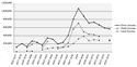
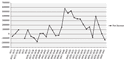
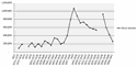 Total Gross Income In Dutch Taiwan, 1631–1661, In Florins Total Gross Income In Dutch Taiwan, 1631–1661, In Florins |
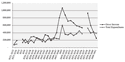 Income Versus Expenditures In Dutch Taiwan, 1633–1661, In Florins Income Versus Expenditures In Dutch Taiwan, 1633–1661, In Florins |
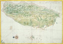
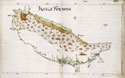 Map of Formosa, c. 1652 Map of Formosa, c. 1652 |
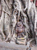 Smoking Buddha, Anping, Taiwan Smoking Buddha, Anping, Taiwan |
|
| Chapter 9 |
 Eighteenth-Century Aboriginal Land Deed in Roman Characters Eighteenth-Century Aboriginal Land Deed in Roman Characters |
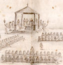
 Landdag Ceremony on Taiwan, c. 1652 Landdag Ceremony on Taiwan, c. 1652 |
 Dutch Governor at the Landdag, c. 1652 Dutch Governor at the Landdag, c. 1652 |
 Elders Dining at a Landdag, c. 1652 Elders Dining at a Landdag, c. 1652 |
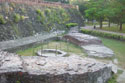
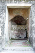 View of Old Entranceway to Fort Provintia (赤坎樓), Tainan City View of Old Entranceway to Fort Provintia (赤坎樓), Tainan City |
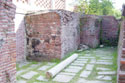 Ruins of Fort Provintia (赤坎樓), Tainan City Ruins of Fort Provintia (赤坎樓), Tainan City |
 Ruins of Fort Provintia (赤坎樓), Tainan City Ruins of Fort Provintia (赤坎樓), Tainan City |
|
| Chapter 10 |
 Zheng Chenggong Ancestral Shrine, Tainan City Zheng Chenggong Ancestral Shrine, Tainan City |
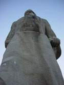 Zheng Chenggong, Statue on Gulang Island (鼓浪嶼), Xiamen, PRC Zheng Chenggong, Statue on Gulang Island (鼓浪嶼), Xiamen, PRC |
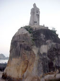 Zheng Chenggong Looks out to Sea, Statue on Gulang Island (鼓浪嶼), Xiamen, PRC Zheng Chenggong Looks out to Sea, Statue on Gulang Island (鼓浪嶼), Xiamen, PRC |
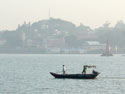 View of Gulang Island (鼓浪嶼) in Xiamen, PRC View of Gulang Island (鼓浪嶼) in Xiamen, PRC |
|
| Chapter 11 |
 Entrances to the Bay of Tayouan, Detail from Nautical Chart, 1636 Entrances to the Bay of Tayouan, Detail from Nautical Chart, 1636 |
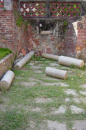
 Remnants of a Well, Fort Zeelandia (安平古堡), Anping, Taiwan Remnants of a Well, Fort Zeelandia (安平古堡), Anping, Taiwan |
 Bird's Eye View of Zeelandia, c. 1652 Bird's Eye View of Zeelandia, c. 1652 |
| Conclusion |
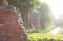
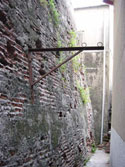 An old wall of Fort Zeelandia (安平古堡), Hidden Behind a Chinese Temple in Tainan City An old wall of Fort Zeelandia (安平古堡), Hidden Behind a Chinese Temple in Tainan City |
 Walls of Fort Zeelandia (安平古堡), Anping, Taiwan Walls of Fort Zeelandia (安平古堡), Anping, Taiwan |
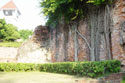
 A Ruined Wall of Fort Zeelandia (安平古堡), Anping, Taiwan A Ruined Wall of Fort Zeelandia (安平古堡), Anping, Taiwan |
 Ruined Wall with Trees, Fort Zeelandia (安平古堡), Anping, Taiwan Ruined Wall with Trees, Fort Zeelandia (安平古堡), Anping, Taiwan |
|
| Appendix C |
| Total Gross Income In Dutch Taiwan, 1631–1661, In Florins |
 Land Income Versus Trade Income In Dutch Taiwan, 1637–1655, In Florins Land Income Versus Trade Income In Dutch Taiwan, 1637–1655, In Florins |
Income Versus Expenditures In Dutch Taiwan, 1633–1661, In Florins |
 Net Income In Dutch Taiwan, 1631–1661, In Florins Net Income In Dutch Taiwan, 1631–1661, In Florins |
|