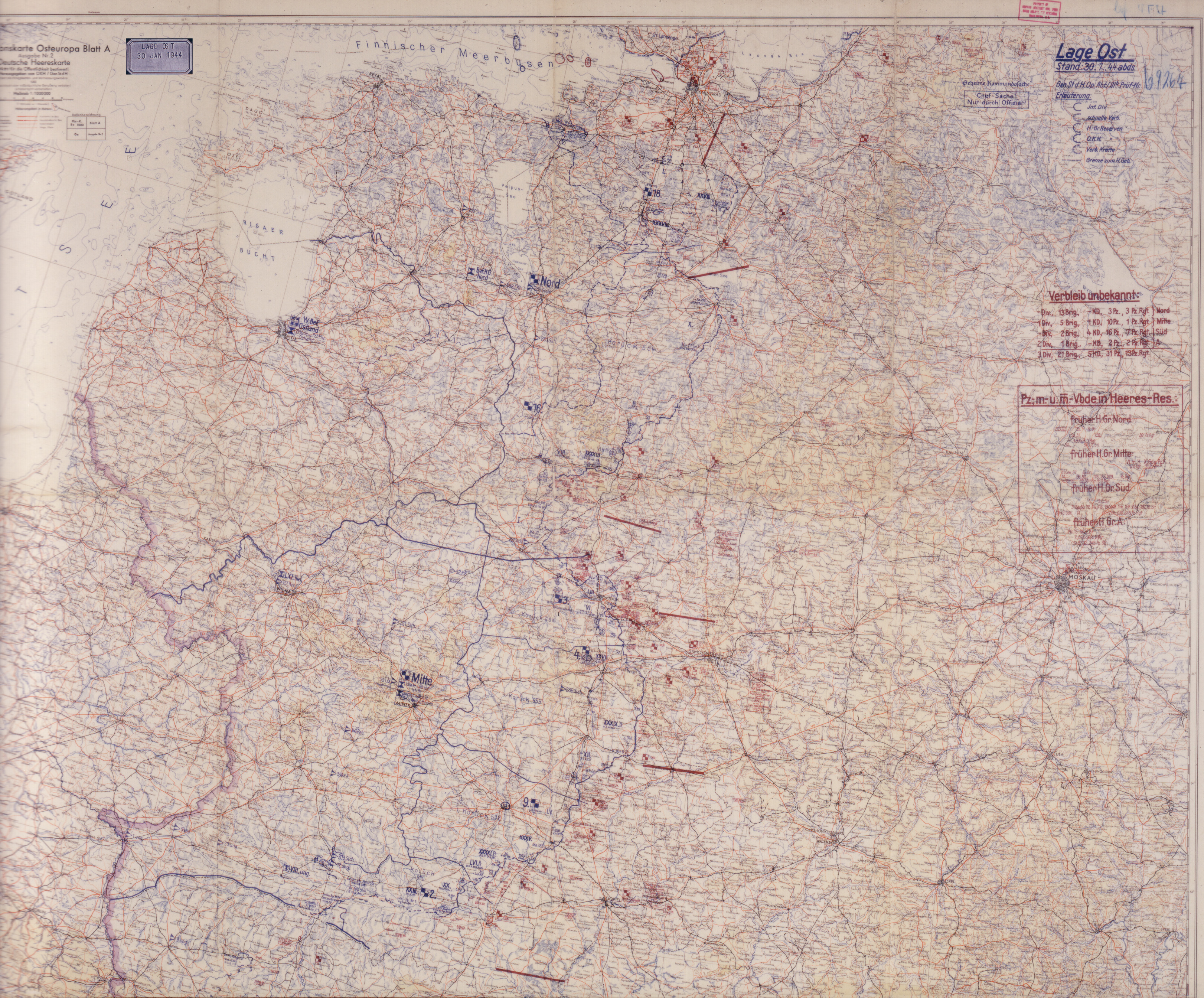
January 30, note "Span. Leg." Near Luga, 18th Army headquarters and XXVI Corps, no longer in action. Full map (multi-MB file).
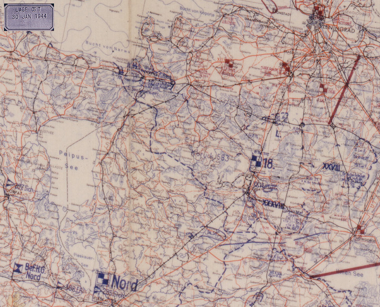
The German Eastern Front Situation Maps, 1941-45, formed part of the Captured German World War II Documents, brought back to the US by the US Army after 1946 and later accessed into NARA as Record Group 242. These consist of the daily maps, in 1-4 sections, depending on the extent of the fronts, produced by the Operations Branch of the German Army High Command (OKH), depicting the German-Axis and known/suspected Russian ground dispositions. Frequently, two sets of maps would be produced covering a single day, one showing ordered movements and the other the final positions. The original maps were finally returned to the Republic of Germany in the 1990s, after being reproduced on 8"x10" color transparencies (each section) for NARA holdings. These can be considered as historically accurate for German and Axis dispositions and a reasonable track of Red Army activities as the German forces knew them.Located in the National Archives II, Cartographic and Architectural Branch: RG 242 Stack 331 Row 77 Compt 15-17 Boxes 1-48.