Interactive Map
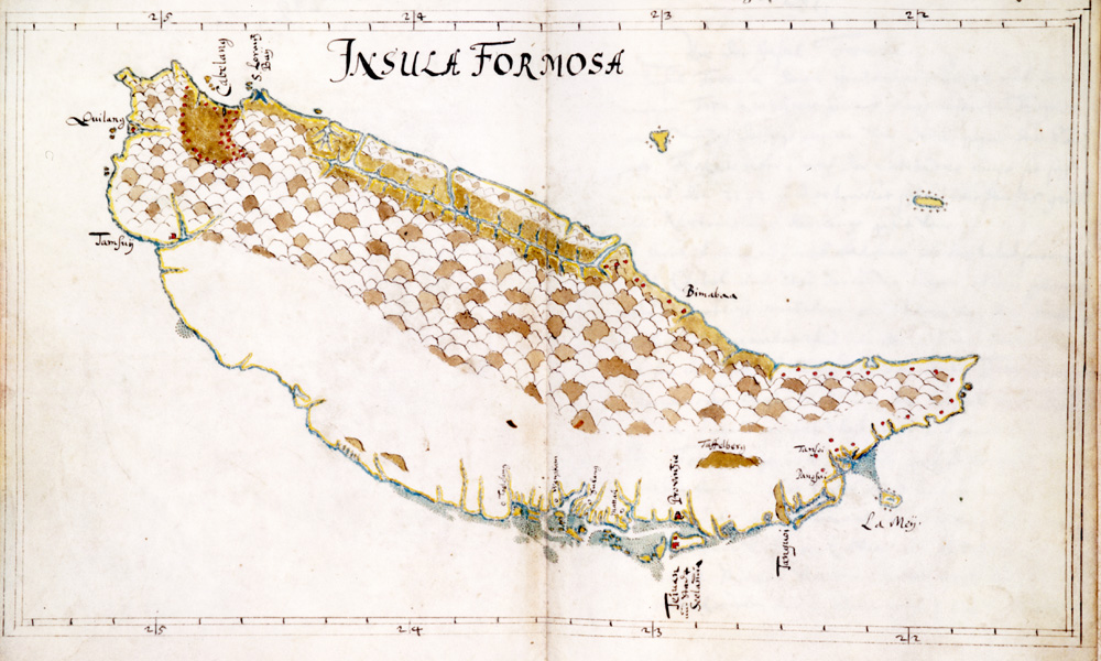
Map of Formosa, c. 1652
This unofficial map, made by Caspar Schmalkalden, after he left the service of the Dutch East India Company is unusual in the detail it provides for the eastern coast. During the early years of the colony, the eastern coast was largely neglected. In the 1640s, however, the company sent several expeditions to reconnoiter the east coast and investigate rumors of gold mines in the mountains. This map reflects the company's newfound knowledge about the geography of the east coast, including the long valley behind the Coastal Mountain Range (海岸山脈) and the Cavalan area. Used by permission of the Gotha Research Library (Gotha Forschungbibliotek) (finding aid: Chart. B 533, fos. 279v-280).
Source: Gotha, Forschungsbibliothek, Chart. B 533
Credit: Caspar Schmalkalden